 |
surfresearch.com.au
rev. parker : columbia river, 1835 |
| home | catalogue | history | references | appendix |
|
Internet Archive
http://archive.org/details/journalanexplor00amgoog
The are some general
descriptions of Honolulu and Waikiki.
Mouth of the Columbia River, 1835.
Page 149
The morning of
the 27th (October) was pleasant and inviting for a water excursion;
but on account of sudden changes of weather which are common at this season
of the year, I did not think it best to cross the wide bay, but took four
Chenook Indians and a half breed, named Thos. Pish Kiplin who could speak
English, and went in a large canoe down to Clatsop and Point Adams, nine
miles from the fort.
There was a gentle
wind from the east, which favored hoisting a small sail.
This gave us
a pleasant sail at the rate of eight ...
Page 150
... miles an hour.
By this time
the waves had so increased and the white caps were so numerous that to
one not acquainted with nautical adventures, the danger in a canoe appeared
great.
We could do nothing,
except to run before the wind, and when we were upon the top of one wave,
it seemed the next plunge would swallow us up.
Fears were of
no use in this situation, and I therefore kept up such conversation as
was calculated to suppress any which might arise in the minds of the men.
It was interesting
to see how the Indians would take the waves with their paddles so as to
favor the safety of the canoe.
But our rapid
progress soon brought us to the shore near Point Adams.
Here a new difficulty,
and unexpected to me, arose, which was, how should we land in the high
surf; but my skilful mariners watched an opportunity to shoot the canoe
forward as far as possible on a flowing wave, and as soon as it broke,
they leaped into the water and seized the canoe and lightened it over the
returning surge, and drew it up beyond the reach of the waves.
This management
was an ocular demonstration of the skill of Indians on dangerous seas.
Sandwich Islands.
Page 343
On the morning
of the 14th of July, land was announced.
The islands of
Ranai and Morakai were near, and as we passed them, we had a near view
of the latter.
It is not so
mountainous as most of the others of the group, and presented rather a
sterile aspect.
We soon after
made Oahu, and passed on the east side around to the harbor of Honolulu
on the south.
This harbor is
the best and almost the only good one in any of the groups of the Polynesian
islands.
The entrance
is somewhat intricate, and requires an experienced pilot to take ships
in safely.
Within the coral
reefs the water is sufficiently deep for ships of almost any magnitude
; and this, with the long extended roads
without the reefs
which affords good anchorage, renders the port desirable, and the island,
in a commercial point of view, the most important of any in this part of
the Pacific ocean.
Page 348
Four miles south-east
of Honolulu is the pleasant native village of Waititi, situated on the
bay of the same name.
It contains five
or six hundred inhabitants, is situated in a beautiful grove of cocoanut
trees, which adds very much to its appearence and comfort.
This place, if
the cultivation was proportioned to the richness of the soil, might be
made one of the most delightful spots on the island.
 |
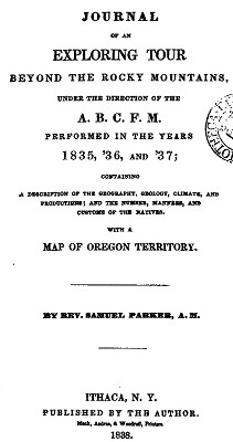
Journal of an Exploring Tour Beyond the Rocky Mountains, Under the Direction of the A.B.C.F.M. Performed in the Years 1835, '36, and '37; Containing a Description of the Geography, Geology, Climate, and Productions; and the Number, Manners, and Customs... The American Board of Commissioners for Foreign Missions Published by the Author, Ithaca, New York, 1838. |

| home | catalogue | history | references | appendix |